Aircraft
A reliable autonomous aircraft loop handles assigned coverage, battery margin, sensor capture, and predictable return behavior.

Horus is not just a drone feed. The system tracks what the aircraft was asked to do, what it actually covered, what it saw, and what a field team should do next.
A reliable autonomous aircraft loop handles assigned coverage, battery margin, sensor capture, and predictable return behavior.
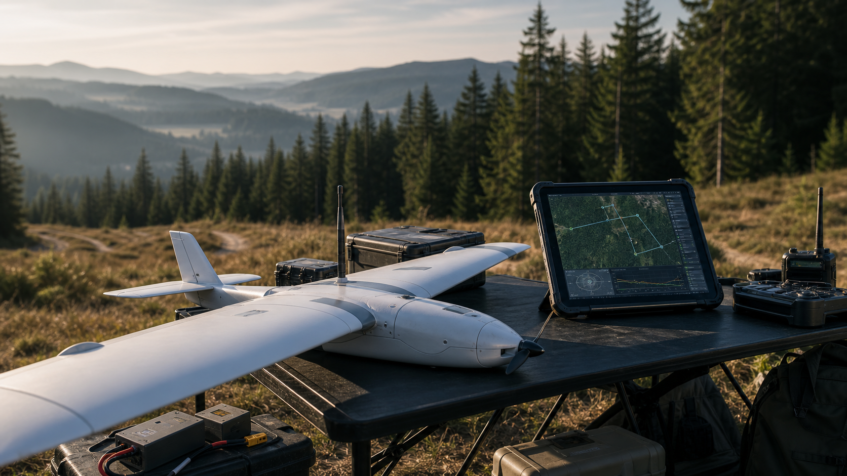
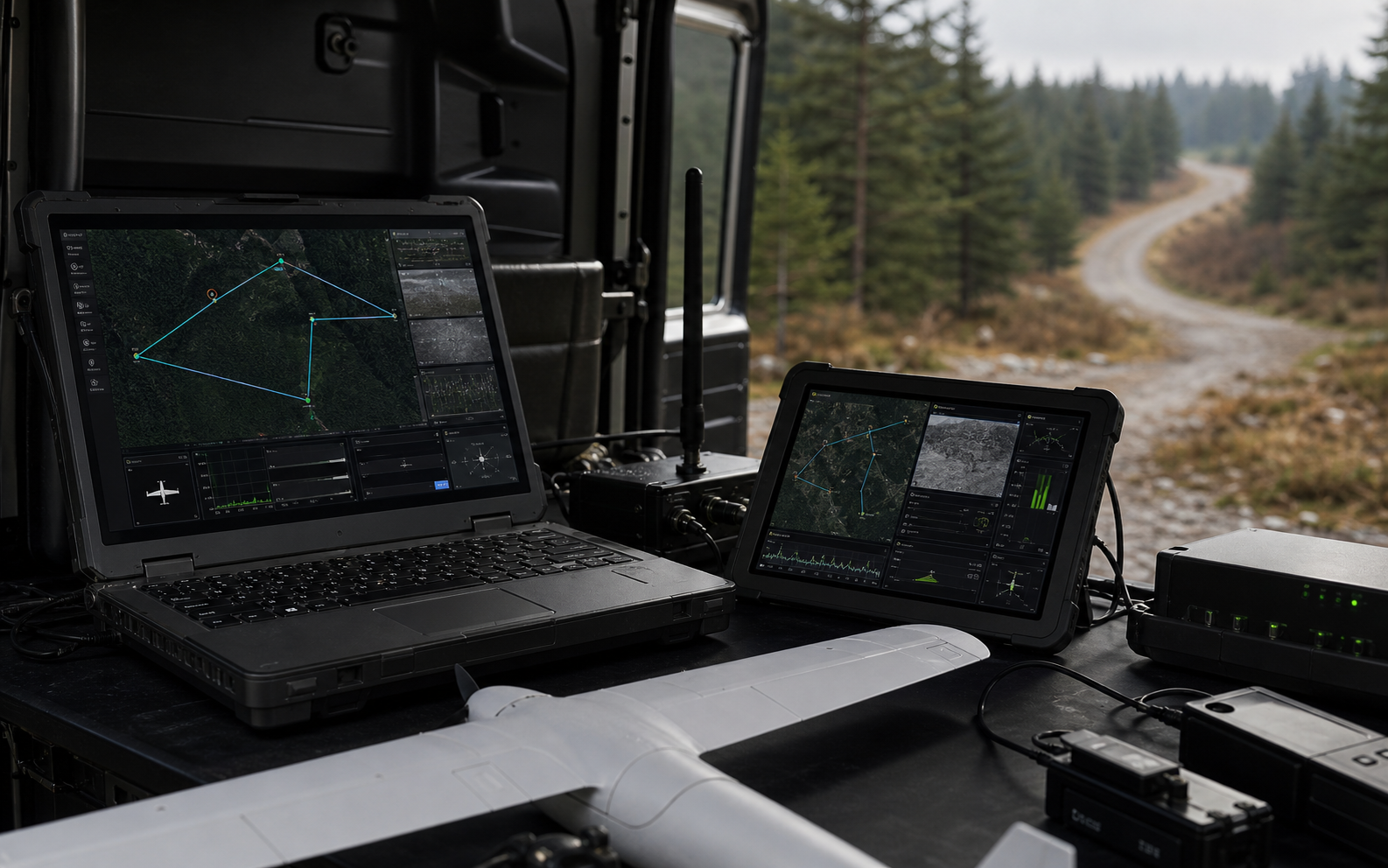
Live aircraft state, route progress, degraded modes, and operator alerts stay visible throughout the sortie.
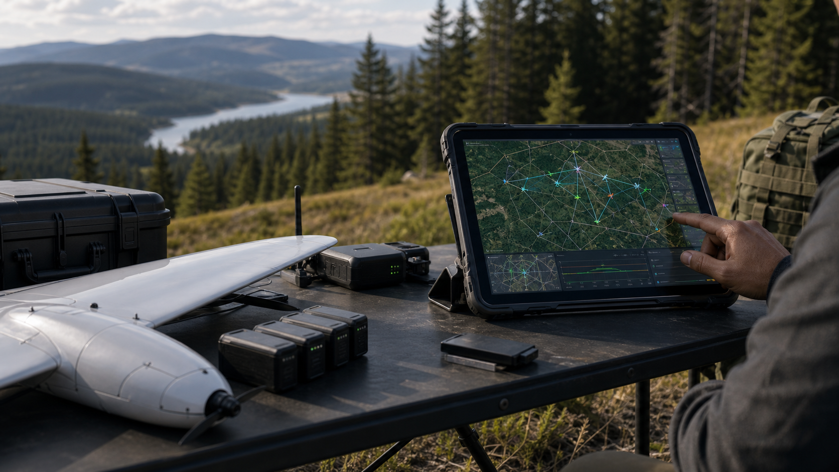
Coverage lanes, priority corridors, detections, handoff points, and field-team context live in a single operational map.
Horus turns raw imagery and route state into ranked observations that humans can verify before escalation.

Horus starts with a reliable single-aircraft operating loop, but the system model is built for supervised fleet growth. The same command surface tracks coverage, route state, aircraft health, reviewed observations, and field handoffs as missions get larger.
Aircraft receive coverage tasks, fly bounded routes, report health, and return home inside known operating envelopes.
Operators see route progress, aircraft status, detections, coverage gaps, and handoff-ready coordinates in one place.
Imagery is ranked for human verification before the system escalates a location to the field team.
Coverage maps, route decisions, detections, and field handoffs become a durable mission record.
The aircraft matters because it reaches the area quickly. The system matters because it turns that flight into a clean decision: where to search next, which lead is worth sending, and what record command can trust after the mission.
Each mission needs a plan before launch, a readable state during flight, and a durable record when the team changes shifts.
Horus captures launch points, terrain limits, no-go areas, battery reserve, communications expectations, and return behavior before a route becomes a task.
The operator sees aircraft health, route progress, coverage state, detections, and unresolved areas without switching between disconnected tools.
Aerial observations become coordinates, imagery, confidence, notes, and response context only after a human has reviewed the evidence.
Each sortie leaves a durable record of routes, coverage, detections, operator decisions, and handoffs that can be reviewed later.