
Define the search box
Set boundaries, launch points, hazards, last-known positions, likely travel corridors, and priority zones before the aircraft leaves the ground.

Search operations usually break down when the team loses track of what has been covered, where the aircraft is now, and which leads are worth sending people toward. Horus keeps the mission plan, aircraft state, sensor observations, and field handoffs in one operating picture so search managers can move faster without losing the record.
The page is built around the same operator loop teams run in the field: plan, cover, review, and hand off.
Set boundaries, launch points, hazards, last-known positions, likely travel corridors, and priority zones before the aircraft leaves the ground.
Task the aircraft across repeatable routes that account for overlap, battery margin, terrain, and safe return behavior.
Surface imagery, confidence, location, and surrounding context for a human to verify before escalating a lead.
Send responders coordinates, reference imagery, confidence, notes, and the route context needed to act quickly.
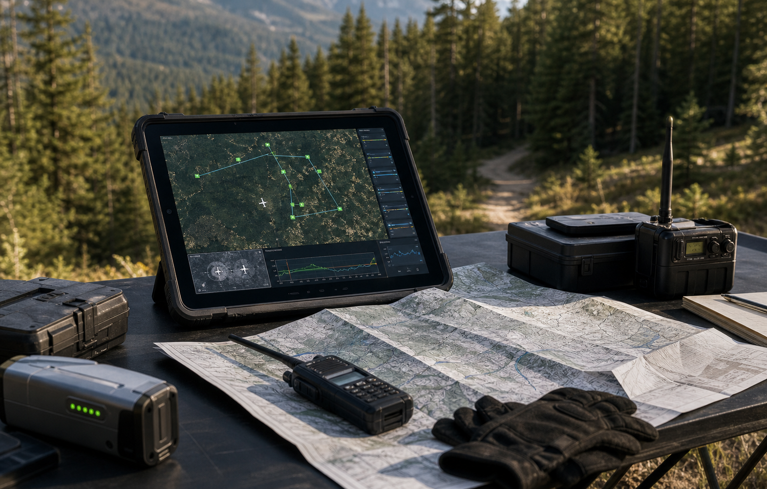
Horus keeps the mission readable while the aircraft is moving: route state, aircraft health, reviewed observations, uncertainty, and field-ready outputs stay tied to the same map.
Every pass is preserved as searched ground, unresolved ground, or priority follow-up so teams do not duplicate work.
Verified points can be handed to field teams in GPS or MGRS with imagery and notes attached.
Command can see aircraft state, detections, route progress, and field response status without stitching tools together.
A search plan only helps if it can keep up with uncertain terrain, partial sightings, battery windows, and people moving on the ground. Horus keeps those constraints visible while the aircraft is in the air.

The system is built to support a search manager, aircraft operator, and field responders at the same time.
Every route updates the searched-area record so command can see what has been covered, what is unresolved, and what should be flown again.
Potential detections are reviewed with imagery, confidence, surrounding terrain, and nearby access paths before they become field tasks.
Verified leads can be handed off with coordinates, reference images, notes, and context that helps responders approach the right place quickly.
Every flight should leave the team with decisions, not just more footage to sort through later.
Share the terrain, response team, site, or mission constraints you care about. Horus can help map the first deployable loop.