
Plan around constraints
Account for launch access, terrain, communications, battery windows, weather, and safe return options.

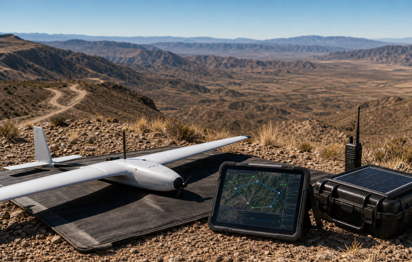
Remote terrain makes every trip expensive: launch windows, radio coverage, batteries, access routes, and weather all matter. Horus helps teams plan aircraft tasks around constraints, capture the mission state, and hand off what matters to people moving across rough ground.
The page is built around the same operator loop teams run in the field: plan, cover, review, and hand off.
Account for launch access, terrain, communications, battery windows, weather, and safe return options.
Send the aircraft over ridgelines, rural corridors, remote assets, or areas that would slow ground teams.
Track searched areas, uncertainty, route progress, and observations so the team knows what is still unknown.
Hand off coordinates, imagery, confidence, and approach notes to responders or crews already working in the area.
Horus keeps the mission readable while the aircraft is moving: route state, aircraft health, reviewed observations, uncertainty, and field-ready outputs stay tied to the same map.
Routes preserve margins for return behavior, relaunches, and changing conditions in sparse terrain.
Coverage, detections, and handoffs remain understandable even when connectivity is intermittent.
The workflow is designed to start with one reliable aircraft and grow toward supervised multi-aircraft coverage.
Remote terrain punishes vague plans. Horus keeps launch access, radio coverage, weather, batteries, terrain, and field movement in the same mission picture.

Horus is designed for places where a second trip is expensive and every route should leave a useful record.
Coverage plans preserve battery margin and return behavior while still reaching ridgelines, roads, and assets that slow ground teams.
Searched ground, uncertain areas, imagery, and route decisions remain readable when connectivity is imperfect.
The operating model starts with one reliable aircraft and is structured to grow toward supervised multi-aircraft coverage.
Every flight should leave the team with decisions, not just more footage to sort through later.
Share the terrain, response team, site, or mission constraints you care about. Horus can help map the first deployable loop.